How damaged is the earthquake in Turkey? This set of satellite images reveals huge ground deformation.
There were two strong earthquakes in Turkey.
On February 13th, The Paper (www.thepaper.cn) reporter learned from the Eighth Institute of China Aerospace Science and Technology Corporation that in order to obtain the coseismic deformation field of this earthquake, scientifically grasp the damage degree of the earthquake, and provide important data support for post-earthquake rescue, the Bureau of Science and Technology for National Defense, the National Satellite Remote Sensing Application Center of the Ministry of Natural Resources, and the National Institute of Natural Disaster Prevention and Control of the Ministry of Emergency Management called the Landsat No.1 01 satellite developed by the Eighth Institute. On February 10th, 2023, the post-earthquake synthetic aperture radar (SAR) image was obtained. After differential interference processing with the pre-earthquake SAR image (April 11th, 2022), the coseismic deformation fields of two strong earthquakes were obtained.
Benefiting from the advantages of L-band radar of Landsat-1 01 satellite, such as long load wavelength and strong penetration of surface vegetation, two SAR images separated by 10 months still maintain high coherence in the coseismic surface deformation area. The InSAR deformation results of Landsat-1 01 accurately describe the damage degree of this earthquake and provide important data support for post-earthquake rescue.
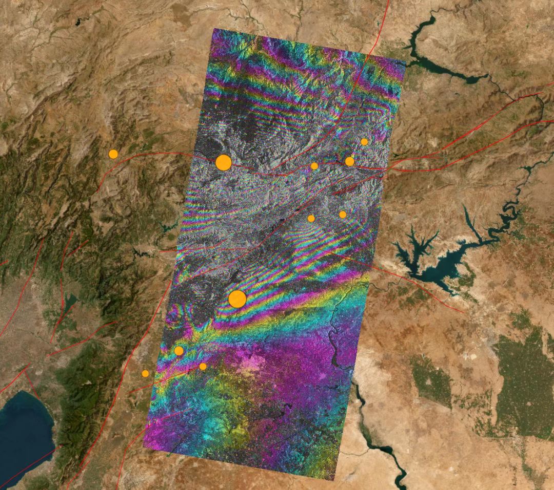
Co-seismic deformation interferogram of Turkey earthquake in 2023 The pictures in this paper are all from the National Institute of Natural Disaster Prevention and Control.
From the coseismic deformation interferogram, it can be seen that the interference fringes in the epicenter area are very dense (a single fringe represents that the surface changes by half the radar wavelength along the line of sight, about 11.9cm), which reveals that the two earthquakes have caused huge surface deformation.
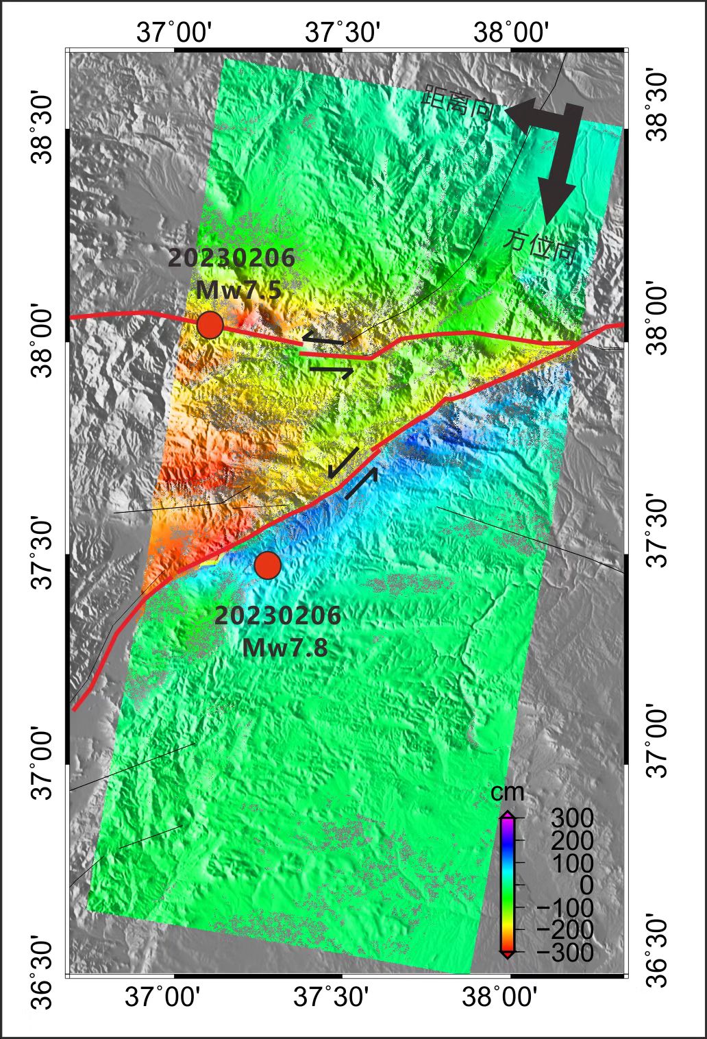
Coseismic deformation field of Turkey earthquake in 2023
From the image of coseismic deformation field, it can be seen that the maximum dislocation amount caused by two earthquakes is 4-5 meters, and the distribution characteristics of InSAR deformation are consistent with the sinistral movement of faults marked by red lines.
According to the Eighth Academy, Group 01 of Land Exploration No.1 is a distributed SAR satellite system, which consists of two L-band SAR satellites with the same design parameters. This group of satellites was developed by the Eighth Academy of Sciences. A and B satellites were successfully launched into orbit on January 26, 2022 and February 27, 2022, respectively, and the world’s first L-band double-star constellation for surface deformation interferometry was constructed. The deformation measurement accuracy can reach millimeter level, which can meet the application needs of land resources, earthquakes, disaster prevention and mitigation, basic geographic information acquisition, forestry and so on, and plays an important role in safeguarding national resource security and ensuring people’s life safety.
At the same time, the Eighth Academy revealed that this group of satellites has been successfully applied to deformation monitoring in typical geological hazard-prone areas such as Datong coal mine in Shanxi and Liupanshui landslide in Guizhou, and also played an important role in demonstration applications such as Luding earthquake in Ganzi Prefecture, Sichuan Province on September 5, 2022.